Showing posts with label Trip Report. Show all posts

Tuesday, March 4, 2014

Short Tours and Dawn Patrols


As I've mentioned, February was an incredibly busy month at work for me. I ended up working more weekends and evenings then I can generally stand. The only thing that kept me marginally sane was the ability to slip away occasionally for a few hours and squeeze in a quick tour on the lower slopes of Ward mountain near our house.


The unusually heavy snowfall we've been getting made for excellent, convenient dawn patrolling. Past attempts to ski on Ward have usually involved hiking to the snow but for the last few weeks it has been possible to ski to and from the car.


The down side of all this snow is that the avalanche danger has also been elevated. Recently a slide even destroyed a home in Missoula. To mitigate risks, I've been practicing obsessive terrain management. I've been studying slope layers on hillmap, carrying an inclinometer and acting under the assumption that anything that can slide will. There are a few small roll overs on the east face of Ward you need to be aware of but it is also possible to find routes through the lower meadows and treed north east ridge line that avoids all terrain steeper then 28 degrees yet offers enjoyable skiing.

Looking down the steep north face.

Snow conditions on these mellow slopes have been generally excellent offering up cold smoke powder. This won't last long and I'm looking forward to skiing some corn on the same slopes. Sunday there was a bit of an inversion with warm pacific air moving in up high. I turned around when the snow began to stick to my skins and a warm breeze could be felt choosing to lap the lower slopes where cold air and powder still lingered.

Lone skin track.


Photos by Jen, motion by Google+
A textbook safe track up a ridge.

Somewhere in the lower meadows. 


Skis on to the car. 

Tuesday, October 29, 2013

Scouting A Ski Tour Before the Storm


This is not a trip report with a map or a location. Rather, it is an encouragement to study maps, dig for clues in old books and online and go out and find an amazing spot that is new to you and do something cool there.


Saturday may have been the last summer like day of the year. An arctic blast arrived Sunday afternoon and the mountains are now sprinkled with snow. Taking advantage of splitter blue skies Saturday we set out to hike another new-to-us bitterroot peak. We found excellent warm fall conditions and a stunning spot we are sure to revisit on skis. Yet another reminder of what brought us to Montana and why we created Hillmap.

Sunday I prepped ski gear. More on that later.

Somebody dug up a bee hive for a snack. 

Wednesday, October 23, 2013

A Fall Day up Mill Creek and Dry Sautéing Wild Chanterelles


We've spent a bit of time climbing at the north rim of Mill Creek and even hiked up to the falls before but we've never been past that. Saturday we set out to rectify that.


The high cliffs and lack of trees from the 2000 Blodgett Fire make Mill Creek one of the most scenic-from-the start hikes in the Bitterroots. The giant sized helping of fall colors we've got this year thanks to a cold-but-dry October only accentuate this.


As with neighboring Blodgett Canyon the trail enters the forest again after 4 or 5 miles. We kept chugging for a bit and then spotted a surprisingly fresh Chanterelle Mushroom. Chanterelles were one of our favorite mushrooms in the Cascades but this was the first time we've found any in the Rockies.


I had wondered if Chanterelles even grew in the Bitterroots but now I think that we just have more to learn about the seasons here. I had assumed that it had gotten too cold for Chanterelles but the ones we found were in good condition. Perhaps with more time and more exploring we'll even learn to find our other favorite fall mushroom, Matsutakes, again.


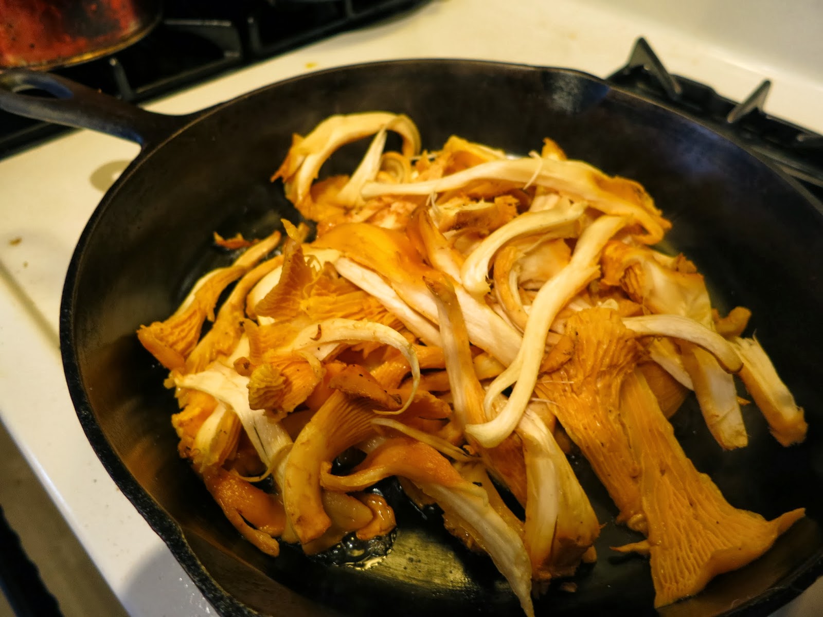
We spent some time poking around the woods out there and found enough mushrooms for an excellent fall dinner of Chanterelle tacos with a mild brie and baby kale. 

I highly recommend this as a simple and quick recipe perfect for post hike. Make sure you "Dry Saute" the mushrooms as described in All That the Rain Promises and More. Tear the mushrooms into long shreds and then start cooking the mushrooms in a hot cast iron pan with a bit of salt but no oil. All of the water from the moist forest and any washing you do will boil out of them and you can pour it off and then add butter.


Pairs well with a single hop ale from Bitterroot Brewery.

Tuesday, October 15, 2013

Postholing on Sweeney Peak

Sweeney Peak

From the crest of Sweeney ridge, you can see into drainages very rarely traveled because they have no trail: North to One Horse Creek Drainage and South to the South Fork of Sweeney Creek.

Pyramid Buttes

The mountains are big and inspiring, and I wonder if they'd be worth the bushwhack, or at least skiing up in winter when the snow covers some of the brush.

Little St. Joe and St. Joe

The Sweeney trail starts up high, the most challenging part of the trip was holding on while the Mighty Honda (Accord) sweated the steep narrow bits beyond the sign that read "Trucks with trailers not recommended beyond this point."

Bass Creek Spires

We followed a good trail up through the forest with tantalizing glimpses to the South of snowy, craggy ridges.  Just past the apex of the trail we stepped over a small stream and headed North to a saddle between two small bumps on the ridge and West up the ridge to Sweeney.


We followed the ridge and a pretty good boot track up.  The snow starts piling up over boot height just beyond a minor peak in the ridge at about 8500'.  There is a bit of crust and consolidation, and the snow pack at around 9,000' is about 2 feet deep - just about knee height.


I might bring snowshoes next weekend unless the weather turns and we get enough snow to cover more rocks.  We stopped shy of the summit - I'll say it's because dense clouds and snow moved in, but really it's because we got tired of punching through snow to the rocks below.  Click here to view and print our map.

Tuesday, September 24, 2013

From Stanley to Sunbeam, from Clayton to Challis....

Harvest moon rising over City of Rocks

This is an eclectic collection of photos, a bit jumbled and wonderful like the backseat (and trunk, and passenger foot well) of our car on our recent road trip through Idaho. We started on a mad dash for the City of Rocks, and then, when camp sites were all reserved on the weekend, we made a detour that unexpectedly followed Yonder Mountain String Band's song, Idaho.

The Toyota Corolla, entirely more hardcore than it seems at first glance.

City of Rocks


First stop: City of Rocks, to take advantage of the perfect fall climbing temps. The undulating landscape of granite domes looked to me like an endless playground.  Two days was not enough time and we'll be back for more.


Ryan got his start climbing here on family vacations, and I can see why!  I don't think it is possible to visit this place and not at least wonder what it would be like to scale the walls and perch up high with the vultures.


Sawtooth Mountains & Red Fish lake


From the City of Rocks we drove North(ish) following the Salmon River from Stanley to Sunbeam where we stopped for awhile at Redfish Lake and hiked up a ridge to get a view of the craggy Sawtooth Mountains.  The renowned Elephants Perch was close enough to taste, but not to see.  Only 5 hours from home.  Then we headed from Clayton to Challis, through the rangeland palace with sage brush all around.


Along the Road


Views from the car were almost as good as the ones farther from the road.  I love a good road trip where there's always the possibility of discovering a new magic spot.  So very many here.


Wild cows of the West

Useful books for this area:

  • Idaho Atlas and Gazeteer - indispensable!  Good to know the locations of campgrounds as well as public land, especially in areas where a smartphone won't work.
  • City of Rocks, A Climber's Guide - Covers routes and areas that are classic, as well as new areas. Lacking some info that I like in guide books such as what size gear to bring (always interesting to climb 2/3 of a pitch and then find out that you really should have brought that number four cam on a route touted as a great hand crack.)
  • Idaho, a Climbing Guide: Climbs, Scrambles and Hikes - Wish we had brought this!  Alas, we left it at home when we thought we'd spend the entire trip at the City of Rocks.  Looks like a really good guide, covers the Sawtooth and other ranges.
  • Hot Springs and Hot Pools of the Northwest - This is the land of hot springs flowing into the Salmon River.  The Forest Service/Visitor Center just South of Stanley also has flyers with some hot springs locations, as well as lots of maps and guidebooks for sale.

Tuesday, September 17, 2013

Fall forWard


We ventured out to our good old standby on Saturday, Ward Mountain.  The clouds tumbled overhead all day amidst a delightfully blue and smoke free sky.


Fall is here up on the slopes, leaves that had not yet succumbed to desiccation are now inching toward red and yellow.


Everyone needs a spot they can head toward on a moments notice that's worth the effort - a hike, bike or run that needs no planning and makes you sweat a bit.


Ward has turned into that place for us: we've been up the trail enough times that we know route finding won't be an issue, and the views of the valley keep us going while the trail climbs and works our legs and lungs.


It's fun to see the small changes creep in on a familiar landscape. This was one of the first truly fall-like days we've had and, coincidently, we also skied on Ward on one of the fist spring-like days earlier this year.